
- All products are added to your cart.
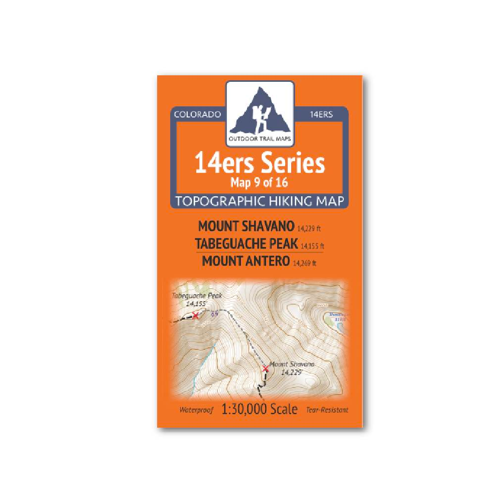
Outdoor Trail Maps 14er Series : Shavano | Tabeguache | Antero Map
14ers Series Topographic Hiking Map 9 of 16 covers fourteeners Mount Shavano and Tabeguache Peak on the front side and Mount Antero on the back, including all hiking trails in the surrounding areas. This rugged trail map was designed for on-trail use in the toughest outdoor conditions and includes the following features:
- Waterproof and tear-resistant paper
- Ultralight weight – under an ounce
- Detailed 1:30,000 scale (1 inch ≈ ½ mile)
- Distances for all trail segments
- Compact folded size to fit in your pocket – only 3.8” wide by 6.5” tall
- Convenient size and foldability for quick and easy on-trail review – 19” wide by 13” tall unfolded – no more fumbling with huge maps while on the go
- All fourteener trailheads – not just the popular ones – with GPS coordinates
- GPS coordinates for all key trail junctions
- Route difficulty classes for each peak
- UTM 1000 m grid along with latitude-longitude ticks
- Easy-to-read and intuitive
The front of 14ers Map 9 shows access to Mount Shavano and Tabeguache Peak from the south / west via the Tabeguache Peak West Ridge Trail and from the east via the Mount Shavano Trail and Colorado Trail from the Shavano/Tabeguache Trailhead and Angel of Shavano Trailhead. Also shown is a stretch of the Colorado Trail north of Angel of Shavano campground and trailhead.
The Map 9 back side shows access to Mount Antero from the 4WD roads to the north and west via Baldwin Gulch as well as from the east and south via Browns Creek Trail and Little Browns Creek Trail from the Colorado Trail and Browns Creek Trailhead. Also shown is the Narrow Gauge Trail and a stretch of the Colorado Trail south from Chalk Creek Trailhead. This is Map 9 of 16 14ers Maps covering all Colorado 14ers.
Add to cart
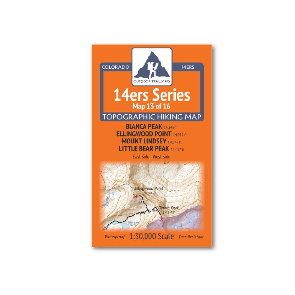
Outdoor Trail Maps 14er Series : Blanca | Ellingwood | Lindsey | Little Bear Map
14ers Series Topographic Hiking Map 13 of 16 covers fourteeners Blanca Peak, Ellingwood Point, Mount Lindsey and Little Bear Peak from the east side on the front of the map and from the west side on the back, including all hiking trails in the surrounding
More info
$5.85
($5.85 Total)

$5.85
($5.85 Total)
Add to cart
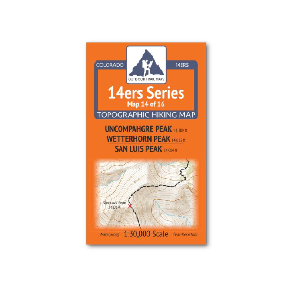
Outdoor Trail Maps 14er Series : Uncompahgre | Wetterhorn | San Luis Map
14ers Series Topographic Hiking Map 14 of 16 covers fourteeners Uncompahgre Peak and Wetterhorn Peak on the front side and San Luis Peak on the back, including all hiking trails in the surrounding areas.
More info
$5.95
($5.95 Total)
